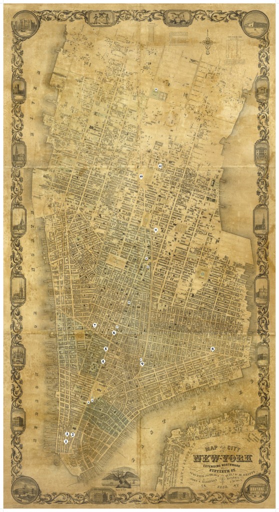
The map below provides a geography of popular entertainment in mid-nineteenth-century New York City.
Matthew Dripps. Map of the City of New York Extending Northward to Fiftieth St. 1852. Published by M. Dripps, New York. Courtesy David Rumsey Map Collection

Principal Circus Venues in New York, 1793–1879
1 – Ricketts’s Circus, 1793, East side of lower Greenwich Street behind Alexander Macomb’s houses
2 – Ricketts’s New Amphitheatre, 1794–96, Southwest corner of Broadway and Oyster Pasty Lane (Exchange Alley)
3 – Ricketts’s New Circus, 1797–99, East side of Greenwich Street at Rector Street
4 – Pepin & Breschard Circus, 1809–12, North side of Anthony (Worth) Street at Broadway
5 – New York Circus, 1812–15, East side of Broadway at White Street.
6 – Broadway Circus, 1817–28, East side of Broadway between Howard and Grand Streets
7 – Lafayette Circus, 1825–26, On Laurens Street (West Broadway) near Canal Street
8 – Mount Pitt Circus, 1826–29, Grand Street and Harmon Street (East Broadway)
9 – Bowery Amphitheatre, 1835-1854, 37/39 Bowery, at Bayard Street Northwest corner of Twenty-third Street and Fifth Avenue
10 – Franconi’s Hippodrome, 1853–56, Northwest corner of Twenty-third Street and Fifth Avenue
11 – New York Circus, or, the Hippotheatron, 1863–72, Fourteenth Street opposite Irving Place
12 – P.T. Barnum’s Great Roman Hippodrome,1873–75 / Gilmore’s Garden, 1876–78 / Madison Square Garden, 1879–1925, Block bounded by Madison and Fourth Avenues and East Twenty-Sixth and Twenty-Seventh Streets
Other Significant Entertainment Venues
A – Park Theatre, 1798–1848
B – Vauxhall Gardens, 1805–59
C – Bowery Theatre, 1826–79
D – Niblo’s Garden, 1828–72
E – Barnum’s American Museum, 1842–65
F – Mechanic’s Hall, 1847-1868 / E. P. Christy’s Minstrels, 1847–57 / Bryant’s Minstrels, 1857–67
G – Astor Place Opera House, 1847–53
H – New York Crystal Palace, 1853–58
